ແຂວງເບັນເຈ
Appearance
ແຂວງເບັນເຈ Bến Tre | |
|---|---|
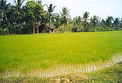
 ຊົນນະບົດ Bến Tre ອ້ອມ Cái Mơn | |
| ຊື່: Land of Coconuts | |
 Location of Bến Tre within Vietnam | |
 | |
| ພິກັດ: 10°10′N 106°30′E / 10.167°N 106.500°Eພິກັດພູມສາດ: 10°10′N 106°30′E / 10.167°N 106.500°E | |
| Country | |
| Region | Mekong Delta |
| Provincial capital | Bến Tre |
| ການປົກຄອງ | |
| • People's Council Chair | Hồ Thị Hoàng Yến (Communist Party of Vietnam) |
| • People's Committee Chair | Trần Ngọc Tam |
| ພື້ນທີ່[1] | |
| • ທັງໝົດ | 2,379.70 ຕລ.ກມ. (920 ຕລ.ໄມລ໌) |
| ປະຊາກອນ (2023) | |
| • ທັງໝົດ | 1,799,328 ຄົນ |
| • ຄວາມໜາແໜ້ນ | 760 ຄົນ/ຕລ.ກມ. (2,000 ຄົນ/ຕລ.ໄມລ໌) |
| Demographics | |
| • Ethnicities | Vietnamese, Khmer, Hoa, Chăm |
| GDP[2] | |
| • Total | VND 41.851 trillion US$ 1.818 billion |
| ເຂດເວລາ | ICT |
| Area codes | 75 (until 16 July 2017) 275 (from 17 June 2017) |
| ລະຫັດ ISO 3166 | VN-50 |
| HDI (2020) | (49th) |
| ເວັບໄຊ | www |
ແຂວງເບັນເຈ ແມ່ນແຂວງໜຶ່ງຂອງ ຫວຽດນາມ . ແມ່ນໜຶ່ງໃນບັນດາແຂວງພາກໃຕ້ຂອງປະເທດ, ແລະຕັ້ງຢູ່ ເຂດທົ່ງພຽງແມ່ນ້ຳຂອງ . ມັນຍັງມີຊື່ສຽງສໍາລັບຫມາກພ້າວແລະ ສາສະຫນາຫມາກພ້າວ ໃນທົ່ວປະເທດ.
ອ້າງອີງ
[ດັດແກ້]- ↑ ແມ່ແບບ:Cite act – the data in the report are in hectares, rounded to integers
- ↑ "Tình hình kinh tế, xã hội Bến Tre năm 2018". Cổng thông tin điện tử tỉnh Bến Tre. Archived from the original on 16 ຕຸລາ 2019. Retrieved 10 May 2020.
- ↑ "Human Development Index by province(*) by Cities, provincies and Year". General Statistics Office of Vietnam. Retrieved September 28, 2024.
