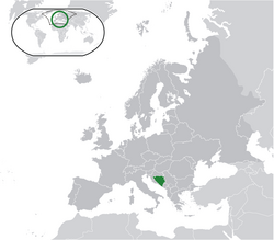
Šiprage
Appearance


ປ່າ (Šiprage) ເປັນຫມູ່ບ້ານໃນ ບອດເນຍແລະເຮີ, ເທດສະບານ Kotor Varos.[1][2]

ພູມິອາກາດ
[ດັດແກ້]ເອກະສານ
[ດັດແກ້]- ↑ KARTA BIH – KARTA BOSNE I HERCEGOVINE, 31/10/2018.
- ↑ Vojnogeografski institut, Ed. (1962): Šiprage (List karte 1:25.000, Izohipse na 20 m). Vojnogeografski institut, Beograd / Military Geographical Institute, Ed. (1962): Šiprage (map sheet 1: 25.000, Contour lines at 20 m). Military Geographical Institute, Belgrade.
- ↑ radohova-905786, 31/10/2018.
ລິ້ງຄ໌ພາຍນອກ
[ດັດແກ້]- [1]
- http://www.maplandia.com/bosnia-and-herzegovina/republika-srpska/siprage/ Maplandia
- http://www.satellitecitymaps.com/europe-map/bosnia-and-herzegovina-map/federation-of-bosnia-and-herzegovina-map/%C5%A1iprage-map/
- http://www.distancesfrom.com/distance-from-Siprage-to-Banja-Luka-Bosna-i-Hercegovina/DistanceHistory/5243320.aspx
- http://www.udaljenosti.com/bosna/-[dead link] Distances in B&H


