
ຮູບ:Java Relief Map.svg

Size of this PNG preview of this SVG file: 800 × 428 ພິກເຊວ. ຄວາມລະອຽດອື່ນ ໆ: 320 × 171 ພິກເຊວ | 640 × 342 ພິກເຊວ | 1,024 × 548 ພິກເຊວ | 1,280 × 685 ພິກເຊວ | 2,560 × 1,370 ພິກເຊວ | 1,587 × 849 ພິກເຊວ
ໄຟລ໌ຕົ້ນສະບັບ (SVG file, nominally 1,587 × 849 pixels, file size: 5.84 MB)
| ລາຍລະອຽດ |
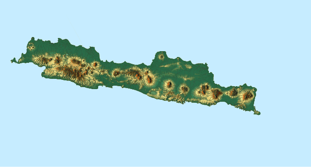
English: Topographic location map of Java, Indonesia
|
| ວັນທີ | |
| Source |
Own work |
| ຜູ້ຂຽນ | Goran tek-en, following request by Darwinek |
| Permission (Reusing this file) |
This file is licensed under the Creative Commons Attribution-Share Alike 4.0 International license. Attribution: Goran tek-en
|
| SVG genesis |
ປະຫວັດໄຟລ໌
ຄລິກທີ່ ວັນທີ/ເວລາ ເພື່ອເບິ່ງໄຟລ໌ດັ່ງທີ່ມັນປາກົດໃນເວລານັ້ນ
| ວັນເວລາ | ຮູບຍໍ່ | ມິຕິ | ຜູ້ໃຊ້ | ຄວາມເຫັນ | |
|---|---|---|---|---|---|
| ປະຈຸບັນ | 18:29, 31 ມັງກອນ 2018 | | 1,587 × 849(5.84 MB) | Goran tek-en | The covering area has been adjusted to fit with File:Indonesia Java location map.svg so they can be used in location template, requested by Joe |
| 19:32, 30 ມັງກອນ 2018 | 1,300 × 417(5.84 MB) | Goran tek-en | {{Information |description ={{en|1=Topographic location map of Java, Indonesia}} |date =20180130 |source ={{Own}}<br> Derived from; * [https://maps-for-free.com/ © OpenStreetMaps contributors], [http://www.openstreetmap.org/cop... |
ການໃຊ້ໄຟລ໌
2 ໜ້າຕໍ່ໄປນີ້ເຊື່ອມໂຍງຫາໄຟລ໌ນີ້:
ການໃຊ້ໄຟລ໌ທົ່ວໂລກ
ວິກິອື່ນ ໆ ຕໍ່ໄປນີ້ໃຊ້ໄຟລ໌ນີ້:
- ການໃຊ້ງານເທິງ ban.wikipedia.org
- ການໃຊ້ງານເທິງ bcl.wikipedia.org
- ການໃຊ້ງານເທິງ bh.wikipedia.org
- ການໃຊ້ງານເທິງ bn.wikipedia.org
- ການໃຊ້ງານເທິງ ckb.wikipedia.org
- ການໃຊ້ງານເທິງ es.wikipedia.org
- ການໃຊ້ງານເທິງ fa.wikipedia.org
- ການໃຊ້ງານເທິງ hi.wikipedia.org
- ການໃຊ້ງານເທິງ ilo.wikipedia.org
- ການໃຊ້ງານເທິງ ja.wikipedia.org
- ການໃຊ້ງານເທິງ ko.wikipedia.org
- ການໃຊ້ງານເທິງ map-bms.wikipedia.org
- ການໃຊ້ງານເທິງ ml.wikipedia.org
View more global usage of this file.