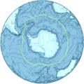
ຮູບ:Antarctica-Region.png
Appearance

ຂະໜາດຂອງຕົວຢ່າງນີ້: 600 × 600 ພິກເຊວ ຄວາມລະອຽດອື່ນ ໆ: 240 × 240 ພິກເຊວ | 480 × 480 ພິກເຊວ | 874 × 874 ພິກເຊວ
ໄຟລ໌ຕົ້ນສະບັບ (874 × 874 ປິກເຊລ, ຂະໜາດໄຟລ໌: 550 KB, MIME type: image/png)
ປະຫວັດໄຟລ໌
ຄລິກທີ່ ວັນທີ/ເວລາ ເພື່ອເບິ່ງໄຟລ໌ດັ່ງທີ່ມັນປາກົດໃນເວລານັ້ນ
| ວັນເວລາ | ຮູບຍໍ່ | ມິຕິ | ຜູ້ໃຊ້ | ຄວາມເຫັນ | |
|---|---|---|---|---|---|
| ປະຈຸບັນ | 03:01, 18 ກຸມພາ 2012 |  | 874 × 874(550 KB) | Ras67 | background removed and file compressed |
| 06:56, 5 ມີນາ 2009 |  | 872 × 872(2.18 MB) | Apcbg | {{Information |Description={{en|1=The Antarctica region and its boundary, the Antarctic Convergence.}} |Source=Own work by uploader |Author=Apcbg |Date=2009-03-05 |Permission= |other_versions= }} This map was created with this [http://www.a |
ການໃຊ້ໄຟລ໌
ໜ້າຕໍ່ໄປນີ້ເຊື່ອມໂຍງຫາໄຟລ໌ນີ້:
ການໃຊ້ໄຟລ໌ທົ່ວໂລກ
ວິກິອື່ນ ໆ ຕໍ່ໄປນີ້ໃຊ້ໄຟລ໌ນີ້:
- ການໃຊ້ງານເທິງ als.wikipedia.org
- ການໃຊ້ງານເທິງ ar.wikipedia.org
- ການໃຊ້ງານເທິງ avk.wikipedia.org
- ການໃຊ້ງານເທິງ az.wikipedia.org
- ການໃຊ້ງານເທິງ ban.wikipedia.org
- ການໃຊ້ງານເທິງ ba.wikipedia.org
- ການໃຊ້ງານເທິງ be-tarask.wikipedia.org
- ການໃຊ້ງານເທິງ be.wikipedia.org
- ການໃຊ້ງານເທິງ bn.wikipedia.org
- ການໃຊ້ງານເທິງ ca.wikipedia.org
- ການໃຊ້ງານເທິງ cs.wikipedia.org
- ການໃຊ້ງານເທິງ da.wikipedia.org
- ການໃຊ້ງານເທິງ de.wikipedia.org
- ການໃຊ້ງານເທິງ dsb.wikipedia.org
- ການໃຊ້ງານເທິງ en.wikipedia.org
- ການໃຊ້ງານເທິງ en.wiktionary.org
- ການໃຊ້ງານເທິງ eo.wikipedia.org
- ການໃຊ້ງານເທິງ es.wikipedia.org
- ການໃຊ້ງານເທິງ et.wikipedia.org
- ການໃຊ້ງານເທິງ fa.wikipedia.org
- ການໃຊ້ງານເທິງ fi.wikipedia.org
- ການໃຊ້ງານເທິງ frr.wikipedia.org
- ການໃຊ້ງານເທິງ fr.wikipedia.org
- ການໃຊ້ງານເທິງ fr.wiktionary.org
- ການໃຊ້ງານເທິງ ga.wikipedia.org
- ການໃຊ້ງານເທິງ gv.wikipedia.org
- ການໃຊ້ງານເທິງ he.wikipedia.org
- ການໃຊ້ງານເທິງ hsb.wikipedia.org
- ການໃຊ້ງານເທິງ hy.wikipedia.org
- ການໃຊ້ງານເທິງ hyw.wikipedia.org
- ການໃຊ້ງານເທິງ id.wikipedia.org
- ການໃຊ້ງານເທິງ ilo.wikipedia.org
View more global usage of this file.


