
ຮູບ:Locatie Middellandse Zee.PNG
ຂະໜາດຂອງຕົວຢ່າງນີ້: 800 × 489 ພິກເຊວ ຄວາມລະອຽດອື່ນ ໆ: 320 × 195 ພິກເຊວ | 640 × 391 ພິກເຊວ | 902 × 551 ພິກເຊວ
ໄຟລ໌ຕົ້ນສະບັບ (902 × 551 ປິກເຊລ, ຂະໜາດໄຟລ໌: 33 KB, MIME type: image/png)
| ລາຍລະອຽດ |
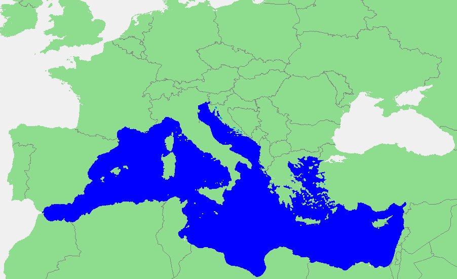
Nederlands: Locatie Middellandse Zee
中文:地中海地图 |
||||
| Source | own work based on PD map | ||||
| ຜູ້ຂຽນ | edited by M.Minderhoud | ||||
| Permission (Reusing this file) |
|
ປະຫວັດໄຟລ໌
ຄລິກທີ່ ວັນທີ/ເວລາ ເພື່ອເບິ່ງໄຟລ໌ດັ່ງທີ່ມັນປາກົດໃນເວລານັ້ນ
| ວັນເວລາ | ຮູບຍໍ່ | ມິຕິ | ຜູ້ໃຊ້ | ຄວາມເຫັນ | |
|---|---|---|---|---|---|
| ປະຈຸບັນ | 18:21, 12 ກັນຍາ 2006 | | 902 × 551(33 KB) | Michiel1972 | {{Information |Description=In dutch: {{subst:PAGENAME}} |Source= own work based on PD map |Date= |Author= edited by M.Minderhoud |Permission= {{PD-Demis}} |other_versions= }} category:Locator maps of seas |
ການໃຊ້ໄຟລ໌
ບໍ່ມີໜ້າໃດ ລິ້ງຄ໌ ຫາ ໄຟລ໌ນີ້.
ການໃຊ້ໄຟລ໌ທົ່ວໂລກ
ວິກິອື່ນ ໆ ຕໍ່ໄປນີ້ໃຊ້ໄຟລ໌ນີ້:
- ການໃຊ້ງານເທິງ ang.wikipedia.org
- ການໃຊ້ງານເທິງ an.wikipedia.org
- ການໃຊ້ງານເທິງ avk.wikipedia.org
- ການໃຊ້ງານເທິງ awa.wikipedia.org
- ການໃຊ້ງານເທິງ bat-smg.wikipedia.org
- ການໃຊ້ງານເທິງ be-tarask.wikipedia.org
- ການໃຊ້ງານເທິງ bm.wikipedia.org
- ການໃຊ້ງານເທິງ ca.wikipedia.org
- ການໃຊ້ງານເທິງ cbk-zam.wikipedia.org
- ການໃຊ້ງານເທິງ cdo.wikipedia.org
- ການໃຊ້ງານເທິງ ceb.wikipedia.org
- ການໃຊ້ງານເທິງ crh.wikipedia.org
- ການໃຊ້ງານເທິງ csb.wikipedia.org
- ການໃຊ້ງານເທິງ de.wikipedia.org
- ການໃຊ້ງານເທິງ el.wikipedia.org
- ການໃຊ້ງານເທິງ en.wikipedia.org
- ການໃຊ້ງານເທິງ eo.wikipedia.org
- ການໃຊ້ງານເທິງ es.wikipedia.org
- ການໃຊ້ງານເທິງ et.wikipedia.org
- ການໃຊ້ງານເທິງ fa.wikipedia.org
- ການໃຊ້ງານເທິງ fiu-vro.wikipedia.org
- ການໃຊ້ງານເທິງ fr.wikipedia.org
View more global usage of this file.